


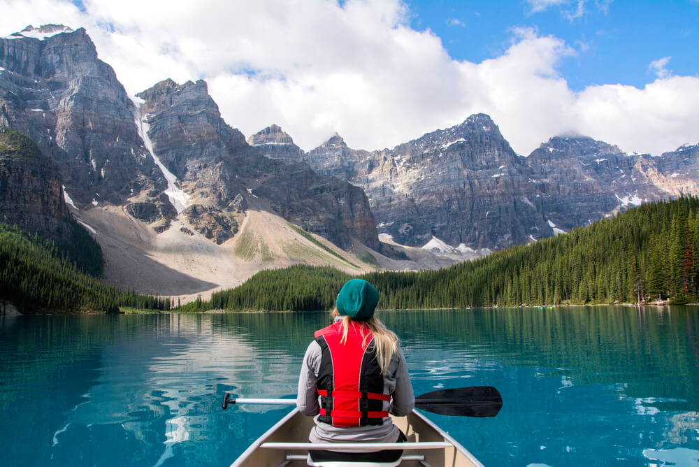
Canada is the second largest country in the world: it occupies a vast territory between the Pacific Ocean to the west and the Atlantic Ocean to the east, between the United States to the south and the Arctic Ocean to the north. Thus, it’s not hard to notice that Canada shares a border with only one country – the United States.
In terms of land area, Canada is second only to Russia, covering approximately 40% of North America, which amounts to 9,976,140 km², where the land area accounts for 9,220,970 km² and 755,170 km² is water surface.
Relief
The Northern Appalachians reach the eastern part of the province of Quebec and the Maritime provinces of the country: Prince Edward Island, Newfoundland, New Brunswick, and Nova Scotia. Along the Atlantic Ocean, the Appalachians create various peninsulas and bays, among which is the famous Bay of Fundy. This location records the highest tides in the world.
The Canadian Shield – one of the largest continental shields in the world, covering an area of about 8 million km². It mainly occupies land within Canada. The Canadian Shield encompasses almost all of Quebec, a large part of Ontario, Manitoba, northern Saskatchewan, and northeastern Alberta, as well as the majority of the Northwest Territories and Nunavut. The total area of the shield is about 8 million km², of which 5 million km² is in Canada, making up 50% of the country's area.
The Canadian Prairies – a large territory in Western Canada covering 1,960,681 km², which includes provinces such as Alberta, Saskatchewan, and Manitoba. Grain crops are grown here, and livestock farming is practiced, making it a key area for agricultural development in Canada.
The Rocky Mountains are included in the list of UNESCO World Heritage Sites. They stretch over 180,000 km² and pass through Alberta as well as British Columbia. The Rockies separate the waters of the Pacific and Atlantic Oceans. Here are the sources of the Missouri, Colorado, Rio Grande, Snake, and Arkansas Rivers. The Rocky Mountains are among the oldest decorations of our planet, estimated to be between 80 to 55 million years old.
When discussing the highest point in Canada, it is undoubtedly Mount Logan (Yukon), with its peak rising to 5,959 m. Mount Logan belongs to the St. Elias Range, which is part of the Cordilleran system. It is estimated that the glacier on the mountain may be several hundred thousand years old.
Canada includes many islands. For example, the largest island in the country is Baffin Island (Nunavut) – with an area of 507,451 km², but due to its harsh climate, only about 11,000 people live here. Also noteworthy is the most densely populated island called Montreal (Quebec), which is home to nearly 2 million people. Don't overlook Prince Edward Island, which essentially constitutes an entire province – here about 140,000 people reside. Among unusual islands is Sable Island (Nova Scotia), known for being extremely narrow: its width is only 42 m. It is also called a “living” island because it moves eastward at a speed of about 220 m per year, gradually disappearing into the Atlantic Ocean.
Hydrography
Canada's national motto “From Sea to Sea” is not without reason, as it is washed by three oceans: the Atlantic, Pacific, and Arctic.
In addition to the oceans, Canada has many large rivers, such as the Fraser, Columbia (British Columbia), Nelson (Manitoba), Churchill (Newfoundland), St. John (New Brunswick), and also the well-known rivers like:
The Mackenzie River (Northwest Territories) – the longest river in Canada, measuring 4,241 km in length. It flows into the Beaufort Sea (Arctic Ocean).
The Saint Lawrence River – a major waterway that is not only an important shipping route in North America but also connects the Great Lakes to the Atlantic Ocean. It begins in Ontario, but most of the cities along its banks are located in Quebec.
Canada is also known as the land of lakes, as it is home to over 2 million water bodies, the largest collection of fresh water on Earth. Among the countless bodies of water, the Canadian lakes or Great Lakes of North America, which are undoubtedly a true treasure of nature. The largest freshwater lake in the world is Lake Superior (Ontario), part of the Great Lakes. It covers an area of 82,100 km², and the water is cold (the temperature in the central part during summer does not exceed 4 °C) and clear. The lake does not freeze in winter due to frequent storms.
In contrast to the largest lake, it is worth mentioning the smallest lake in the lake system. We are talking about Lake Ontario, located in the province of the same name. But Ontario is not only the smallest lake (with an area of 19,000 km²), it is also the easternmost in Canada and very picturesque.
Canada boasts many not only lakes but also numerous waterfalls, such as Lower Falls (Alberta), Rideau Falls (Ontario), Chute de la Chaudière (Quebec), Helmcken Falls (British Columbia), Athabasca Falls (Alberta), Shannon Falls (British Columbia), Takakkaw Falls (British Columbia), Virginia Falls (Northwest Territories), Montmorency Falls (Quebec), Kakabeka Falls (Ontario), and the most famous in Canada – Niagara Falls.
Niagara Falls is actually a complex of waterfalls on the Niagara River, which in turn separates the state of New York in the USA from the province of Ontario in Canada. The most famous and picturesque of the waterfalls in the complex is the Horseshoe Falls, which is commonly referred to as Niagara Falls. The waterfall is 792 meters wide and 51 meters high.
It is also worth mentioning the highest waterfall in Canada – Della (British Columbia). Its height is 440 meters, but reaching it is not easy: either by helicopter or by boat through Central Lake, and the tour and hiking path to the waterfall takes no less than 8 hours.
Fiords
A fiord is a narrow sea inlet deeply carved into the land with steep slopes. They are typically very scenic. Most fiords are located in Norway, but there are several in Canada as well: Howe Sound (British Columbia), Saguenay Fiord (Quebec), Tanquary Fiord (Nunavut), Eglinton Fiord (Nunavut), Sam Ford Fiord (Nunavut), Knight Inlet (British Columbia), Indian Arm (British Columbia), Jervis Inlet (British Columbia), and Burrard Inlet (British Columbia). While some of them can only be accessed by helicopter or icebreaker, the incredible Scandinavian views seen there are worth it.
} Note: Ensure that you adhere strictly to the instructions provided and do not deviate from the format or content. Thank you!